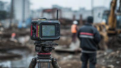
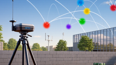
Picking an Rtk Survey Machine isn’t just about hunting for the lowest accuracy number. Honestly, out in the field, it’s a whole different story – you’ve got to think about correction coverage, how many satellites you can see, how long it takes to set up, and whether your crew can quickly confirm they’ve got a solid fix. NOAA’s National Geodetic Survey says real-time GNSS can hit centimeter-level accuracy under the right conditions, but hey, that’s not a guarantee on every job site. You know, things like trees, reflective walls, weak mobile coverage, or a poorly placed antenna—they can really mess up your measurements. So always double-check what’s actually going on behind those specs you see quoted.
You know, Chris Rizos, the GNSS researcher, keeps hammering home that you’ve got to see how positioning systems actually behave out in the real world, not just in a lab. So what does that mean for you when you’re buying? Honestly, it’s pretty simple: look at the whole workflow, not just the receiver. A decent unit should clearly show you its correction status, reconnect without giving you grief, and log field data without making you jump through hoops. And for crying out loud, test it on the kind of site your crew actually works on—a pristine, open test pad just doesn’t cut it.
You really gotta get up close and personal with the controller ergonomics, check out how long the battery lasts, and don’t forget to look into what correction services are actually supported—plus whether there’s any local tech support that won’t leave you hanging. Also, ask them to show you the documented accuracy specs, both horizontal and vertical, and don’t just take those numbers at face value—find out what test conditions they used to come up with them. Once you have that, compare it against your own project tolerances. It’s the little things that can trip you up, you know? Like, a screen that stays readable under bright sunlight can save you so much hassle, but if the status icons are confusing or poorly designed, it’ll just make you second-guess everything. And here’s the thing—even if the equipment is top-notch, it still needs to be set up properly. That part always gets overlooked, and honestly, it’s easier to underestimate than you’d think. So, in the sections ahead, I’m going to walk you through a practical way to compare specs, test reliability, and pick an Rtk Survey Machine that actually fits into your team’s everyday workflow—not just on paper, but in the real grind.
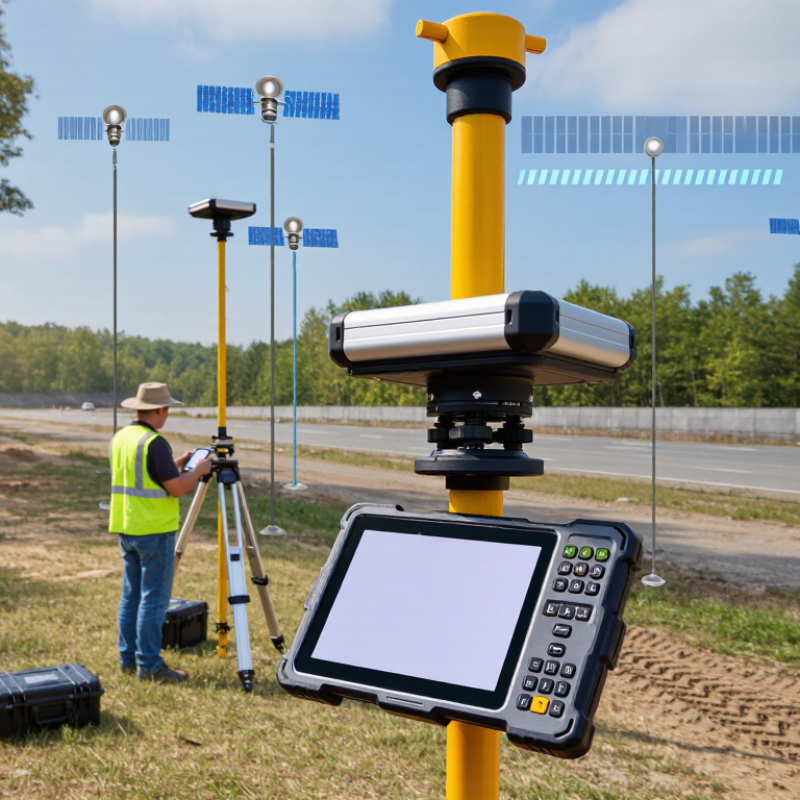
Define the Survey Task Against Typical RTK Accuracy of 8 mm + 1 ppm Horizontally
An RTK survey machine rated at 8 mm + 1 ppm horizontally offers a useful benchmark, not a guaranteed result. The ppm term adds about 1 mm of error per kilometre of baseline. At a 2 km baseline, the stated figure is roughly 10 mm under specified conditions. Check the test conditions behind the number.
Match that accuracy to the work. Setting out a building grid may require tighter checks than mapping broad site features. For a curb layout, a few millimetres can affect alignment; for a preliminary terrain survey, that difference may matter less. Check the site first. Trees, walls, and reflective glass can interrupt satellite signals or create multipath errors. A fixed RTK solution does not automatically mean every point is reliable.
Before buying, test the receiver on a representative site and compare its readings with known control points. Record the baseline length, time to fix, and repeatability after moving between points. Also check correction-link stability and how the system reports a lost or degraded fix. I would not judge a unit from one clear-sky demo; that is an easy test to pass. Real sites are less tidy. Keep the task tolerance, field conditions, and verification routine in the same decision.
Compare GNSS Constellation Support Across GPS, GLONASS, Galileo, and BeiDou
A reliable RTK survey machine should track more than GPS. GPS offers broad coverage, while GLONASS, Galileo, and BeiDou add satellites from different orbital systems. In a narrow street, extra signals can help maintain a position fix when buildings hide part of the sky. That matters.
Compare the receiver’s actual constellation support, not just a checklist in a product description. Check which signals and frequency bands it tracks, and whether your correction source provides compatible data. The rover and base station need enough shared observations for RTK processing. Ask about this before buying, especially if you use a regional network. More satellites sound better, but compatibility and signal quality still count.
Field conditions change the result. Near a concrete wall or under wet tree branches, reflected signals can distort measurements even when the screen shows many satellites. Galileo and BeiDou may improve availability in some locations, but they cannot remove multipath errors. Test the machine on your usual site, compare fixed-solution rates, and note how quickly it recovers after losing lock. I would also check firmware support; it can be easy to overlook, and documentation is not always clear.
Check Signal Tracking for L1, L2, and L5 Multi-Frequency Reception
When choosing an Rtk Survey machine, check what “L1, L2, and L5 support” means in practice. A receiver may list these frequencies but track them only with particular satellite systems or signal types. Read the detailed tracking specifications, not just the product summary. That matters.
L1 is widely used, while L2 and L5 can provide additional observations for processing and signal checks. Multi-frequency measurements may help a receiver resolve ambiguities and reduce ionospheric effects, but they do not guarantee a fixed solution under trees or beside tall buildings. Test the receiver where you plan to work. Watch how quickly it fixes, whether the solution remains stable, and how often signal tracking drops.
Check the antenna specifications too; receiver capability alone does not tell the whole story. If possible, review raw observation logs and compare performance on a known baseline. Note the satellite systems and frequencies recorded, then repeat the test in open sky and near obstructions. A clean specification sheet can still leave questions. I would not choose from a frequency list alone. Real field conditions are messier than a brochure suggests.
How to Choose the Best RTK Survey Machine: Check L1, L2, and L5 Signal Tracking
Compare the nominal carrier frequencies of the GPS L1, L2, and L5 signals. When evaluating an Rtk Receiver, check its specifications for tracking support across the frequencies you need.
Nominal GPS carrier frequencies: L1 = 1575.42 MHz, L2 = 1227.60 MHz, and L5 = 1176.45 MHz. Frequency support alone does not indicate tracking quality; also review receiver specifications and performance under your operating conditions.
Match Correction Links to the Site: UHF Radio, Cellular NTRIP, or Both
Rtk Positioning is only as dependable as the correction link reaching the rover. Cellular NTRIP can work well near a stable mobile network, especially across spread-out sites. Check coverage where crews will actually work, not just at the site entrance. A phone showing signal beside the truck proves little. In a low spot or behind a concrete structure, corrections may drop or arrive late.
UHF radio can suit remote areas without reliable cellular service, but range depends on terrain, antenna height, and obstructions. A ridge may block the signal even when the base seems close. Some Rtk Survey Equipment supports both radio and cellular links, giving crews another option when conditions change. That flexibility adds setup choices, and it does not remove the need to test. The best link is site-specific. I still find this easy to underestimate.
Tips: Walk the site before choosing. Check correction age and fix status at several points, including near buildings and tree lines. Confirm the correction service, radio coverage, and backup plan with the survey team. Keep notes; coverage can change after one small move.
Verify Field Protection: IP67 Means Dust-Tight and Immersion to 1 m for 30 Minutes
When choosing Rtk Gps Survey Equipment, check the enclosure rating before trusting it on a wet, dusty site. Under IEC 60529, IP67 combines two test classifications: “6” means dust-tight, while “7” means protection during temporary immersion. The specified immersion test is up to 1 metre for 30 minutes. That is a controlled test, not a promise of survival in every field condition.
Picture a receiver beside a muddy trench, with fine grit settling around its connectors. A dust-tight rating helps keep particles from entering the enclosure during the specified test. After a brief drop into shallow water, the immersion rating offers useful protection. Still, damaged seals, loose covers, or repeated impacts can change the outcome. Not magic.
Read the complete test conditions in IEC 60529, rather than relying on “waterproof” wording alone. Check that port covers close firmly, and inspect seals for cuts before deployment. Also consider water temperature, movement, and exposure time; these may differ from laboratory conditions. IP67 does not certify resistance to high-pressure jets or long submersion. A quick field check helps, but it cannot replace the stated test limits.
Compare Battery Runtime, Controller Compatibility, and Total System Weight
How to Choose the Best RTK Survey Machine
When choosing equipment for a Real Time Kinematic Survey, compare battery runtime under actual field conditions, not just the manufacturer’s best-case figure. A receiver that lasts eight hours in mild weather may drain faster in cold conditions or while tracking many satellites. Consider your longest workday, setup time, and whether spare batteries are easy to carry. A shutdown near the end of a site visit can mean repeating measurements. Not ideal.
Controller compatibility matters just as much. Check whether the receiver works with your existing controller, field software, and data formats. Confirm connection options and test the workflow before purchase. Switching systems may require retraining or extra cables, costs that are easy to overlook. I have learned that “compatible” can still mean a few frustrating setup steps.
Tips: Weigh the complete kit: receiver, controller, pole, batteries, and mount. Carry it for a short trial over uneven ground. A lighter setup can reduce fatigue, but very light poles may feel less steady in wind. Record battery use across a full shift, too. Field notes beat guesses.
How to Choose the Best RTK Survey Machine: Compare Battery Runtime, Controller Compatibility, and Total System Weight
Comparison notes:Figures are indicative ranges for common Rtk Rover configurations, not guaranteed specifications. Total working weight includes the receiver, handheld controller, and a 2 m survey pole; it excludes a carrying case and optional accessories. Actual runtime varies with temperature, screen brightness, satellite tracking, radio or cellular use, and battery condition. Always confirm the specific equipment and software specifications before purchase.
FAQS
Extra satellites can help maintain a position fix when buildings block part of the sky. They do not guarantee better accuracy.
Check tracked signals and frequency bands. Confirm that your correction source and base station provide compatible data.
No. Reflections from concrete walls or wet branches can distort measurements. A crowded satellite display can still be misleading.
Test at familiar locations. Record fixed-solution rates and how quickly the receiver recovers after losing satellite lock.
It can work well where mobile coverage is stable. Check signal strength in low spots and behind structures, not only beside the truck.
It may suit remote areas without reliable cellular service. Hills, low antennas, and other obstructions can reduce its range.
Both can provide flexibility when site conditions change. They still need setup and testing; extra options do not solve every connection problem.
Check correction age, fix status, and link coverage near buildings and tree lines. Keep notes. Small location changes can matter.
Conclusion
Choosing the right Rtk Survey Machine starts with the work you need to perform. Use the typical horizontal accuracy of 8 mm + 1 ppm as a reference, then consider whether your project’s required precision and working conditions call for additional capabilities. Check support for GPS, GLONASS, Galileo, and BeiDou, since access to multiple satellite constellations can help maintain reliable positioning. Multi-frequency tracking across L1, L2, and L5 is also worth comparing, particularly when survey conditions make consistent signal reception important.
Next, match the correction link to your site: UHF radio, cellular NTRIP, or a receiver that supports both. For field durability, an IP67 rating means the unit is dust-tight and can withstand immersion in up to 1 meter of water for 30 minutes under specified test conditions. Finally, compare battery runtime, controller compatibility, and the combined weight of the equipment. Considering these factors together helps you choose a practical system for your tasks and daily fieldwork.
 +86 13717134343





 CONTACT PDS
 CONTACT PDS
 CONTACT PDS